LiDAR Mapping Services in Mexico and Latin America
We use the latest geospatial technology to collect positional data for our client’s assets. Whether for transmission lines, roads, railway, or for large area survey, LiDAR provides an effective method to survey both the natural and urban environment.
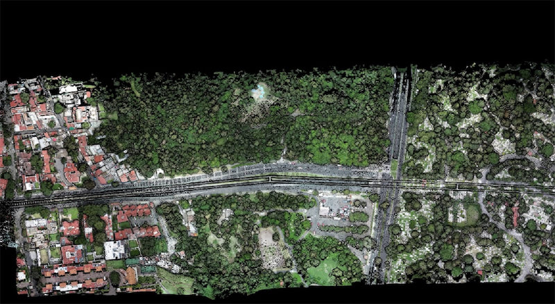
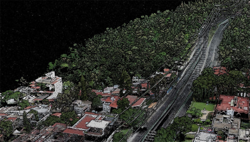
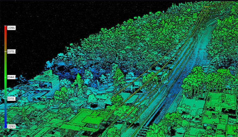
LiDAR (Light Detection and Ranging) provides accurate 3D data that can detect objects in real space with relatively high precision and accuracy, depending on the LiDAR unit’s specifications. UAV LiDAR involves a drone flying over a set area while a sensor sends out laser pulses at a rate of 100k-3million pulses per second onto a surface and measuring the time it takes for the signal to return. LiDAR Data is electronically compiled with GPS data and data from the inertial measurement unit (IMU) to create a digital representation of the scanned area in a point file format, which professional surveyors can then use to build a great number of deliverables for their clients. All options have advantages but the best method simply depends on the specific aims of a given project.
Using LiDAR technology, we can provide a number of geospatial outputs such as the following:
Density Measurement
LiDAR-equipped drones can reach the ground surface through small openings in the canopy, foliage and plant-life, capturing depth data that’s hard to collect by traditional methods – useful for industries such as Agriculture, Forestry, Surveying, and Land Management/ Development.
Detailed Detection
LiDAR equipped drones can fly at low altitudes and reach ground through heavy vegetation, enabling precise collection of locational data. This is especially valuable for Archaeology, Precision Agriculture, Land Development, and Energy & Utilities.
Volumetrics
LiDAR drone technology can be used to collect data that will enable licensed professionals to measure the volume contained within an area. Good for mining and aggregates stockpiles, dredging, landfills and industrial sites, or any location where volume measurement is vital.
Elevation Modeling
LiDAR data can be used by licensed professionals to create high-precision 3D models that deliver robust information not possible with traditional means, like finding the low points on farmland for irrigation planning. Useful for many industries, including Land Management, Agriculture, Civil Engineering, and Construction.