Extend your horizons
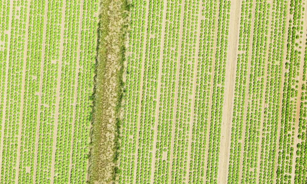
Drone technology has left a lasting impact on Mexico’s agricultural industry and its efficiency. We present drone-powered solutions to farmers to increase productivity in crop and planting monitoring, livestock management, crop stress identification, treatment planning, plant growth monitoring.
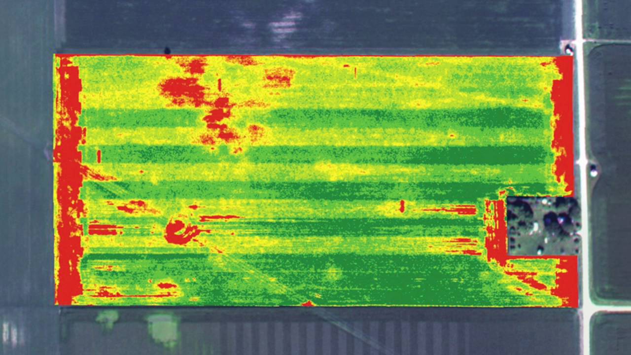
We analyze the vegetation, obtaining data such as water stress, health level, chlorophyll status and other characteristics, serving for a highly productive crop and agricultural harvest.
Using NDVI images and other indices (such as the normalized vegetation index), the state of the crop can be analyzed quickly and safely.
We use high-tech aerial surveying drones equipped with advanced sensors, such as RGB and multispectral sensors, to obtain accurate data. Our drones accumulate high resolution crop data to identify any problems with crops and notify them for immediate action before damage occurs. Geotagging aerial images provide valuable information that reduces costs and increases performance by a significant percentage.
Advanced drone technology and the use of Machine Learning for precision agriculture result in better crop yields and profitability. Consequently, lower levels of standard inputs are required from farmers to cultivate and maintain land, water, fertilizers, herbicides, and insecticides.
We combine aerial imagery through the use of drones with machine learning systems for crop yield forecasting, accurate crop counting, crop emergency analysis, irrigation monitoring, crop health, crop damage assessment, soil analysis of field etc High quality drone data and photogrammetry protection crops to ensure productivity and equip farmers with all accessible benefits.
Crop Health and Stress Analysis
Our top-notch drones furnished with Multispectral camera sensors can identify disease and stress in the initial stages, sometimes before it is even evident from the ground or with standard color cameras. Our drone surveys also provide real-time imagery of the fields for precision agriculture. The data obtained is processed and analyzed during Irrigation Monitoring, Corp Health Monitoring, and other fundamental elements to encourage farmers to focus on treatment plans.
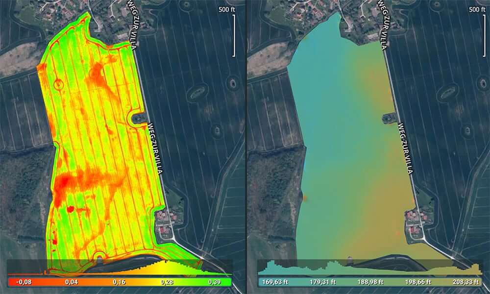
IRRIGATION MONITORING AND PLANNING
Our drones equipped with Thermal Cameras and Remote Sensing capabilities can help defeat irrigation issues, or areas receiving little or too much moisture. The topography of fields from RGB Imagery assists farmers to position and segregate the crops to maximize drainage, follow natural land runoff, and to avoid water-logging. With our services, farmers will be able to adapt to different environments comfortably.
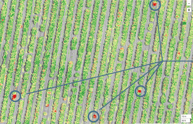
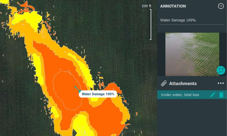
CROP DAMAGE ASSESSMENT
Our experienced drone pilots can obtain high-resolution data that can provide vital information for measuring and documenting damage to crops from unforeseen factors such as floods, fires, pests, weather events, etc. Data from drones with remote sensing capabilities and Photogrammetry acts as evidence for farmers or government authorities to claim crop insurance or to obtain an estimate accordingly. Data retrieved from advanced sensors represented as 2D or 3D Orthomosaics help farmers understand and find novel alternatives to increase crop yields and reduce crop damage simultaneously.
CROP COUNT & PLANT EMERGENCE ANALYSIS
With our drones’ high-resolution data coupled with Machine Learning algorithms, we can efficiently present production information to track crop emergence, drive replanting decisions, and help predict yield. Data obtained with premium UAVs and Photogrammetry , our system yields 97% accuracy in its output. We represent these as 2D Orthomosaics for an in-depth understanding.
FIELD SOIL ANALYSIS
The soil quality of crops can either make or break a farmer’s productivity. Soil Analysis is a crucial step to be taken by farmers during the crop-cycle. Our drones, provide real-time and precise analysis of soil’s overall health. Through Precision Agriculture, one can discern issues surrounding soil quality, nutrient management, or dead soil zones. This data supports farmers in determining the most effective farming patterns of planting, managing crops, and soil. Not to mention, field soil analysis also increases the safety and health of workers.