
With our modern drone technology we provide Aerial Mapping / Surveying for Mining Industry. We’ve experience with Government and Private companies with grand success for improvement of efficiency and productivity of large mine sites. We even cater to project managers with stockpile management by quick, accurate, and real-time monitoring. Having satisfied Centimeter Level Accuracy, our GIS maps assist operation managers in the process of enhanced decision-making, allowing mines to be more productive and smart. Along with 30x faster data collection and 100% safety Drone Powered Surveys, smart management allows companies to keep track of stockpile management, Mining operations, Haul road optimization, water and sediment flow, mining exploration, mine blast assessment, etc.
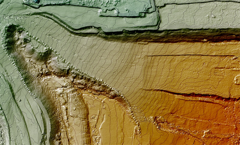
All drones used by us are high-end quality and are outfitted with RGB sensors to acquire aerial data of mining sites. Our GIS experts intensify the data accumulated and portray them as Geotagged 3D maps, Contour lines, 3D Point cloud, Digital Elevation Models (DEM), Digital Terrain Models (DTM), or Digital Surface Models (DSM). These models mirror vital characteristics such as safety berm heights, crests and toes, road boundaries, slope length, elevation change, etc., which promote the improvement of worker and site-safety management.
With our drones and professional data analysis software we can provide volumetric calculations remitting a 99% accuracy guarantee.
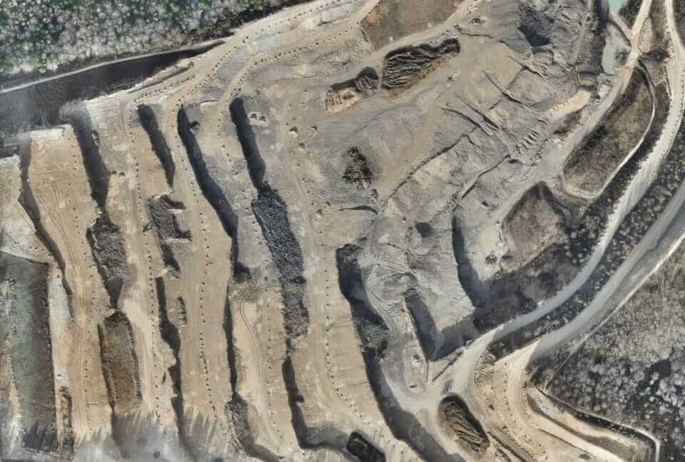
Stockpile management
Regardless of your work in the construction, mining, or aggregate sector, stockpile management is a must. Assigning your workforce for stockpile measurement can be hazardous, time-consuming, and costly. All stockpiles vary in shapes and sizes, making it challenging to estimate their volumes with high accuracy through traditional methods. Instead, the most optimal resolution would be to use high-quality drones to accumulate survey data. We advance stockpile volume estimation with 99% accuracy and further defeat issues concerning mine operations and personnel safety.
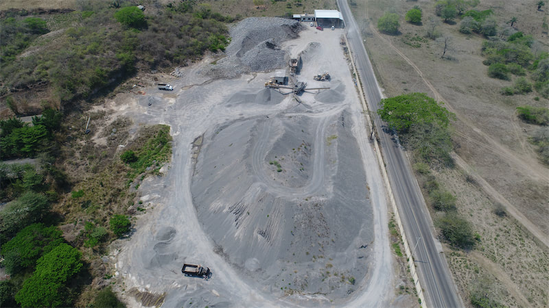
Mine Monitoring and Operation Planning
We encourage mining site managers to outline and maintain site operations efficiently. Our highly accurate drone data and GIS maps help design haul roads accurately, optimize traffic flow, and initiate team collaboration to ensure quick decision making to restore and retain safety.
Haul Road Optimization
Periodic inspection and assessment of haul roads are vital to ensure the smooth running of mining operations and diminishing possibilities of a catastrophic event. As opposed to traditional methods, Drone Surveying preserves time, money, and acquires data that could never be obtained by human surveyors. Our skilled GIS crew produces various GIS maps like DTM, 3D Models, 3D Point Clouds, Color Slope Maps, etc. to provide excellent and valuable knowledge such as length, slope, and turning angles to mine managers. With this information, our clients can optimize the roads and significantly diminish fuel costs for moving materials out of mining sites.
Mining exploration
UAVs (Unmanned aerial systems) are continually growing as a less invasive approach for procuring authentic images for mineral exploration due to its safe, efficient, and sustainable nature. Our drones equipped with advanced RGB sensors, produce high-quality data, which further promotes our team to generate high-resolution orthophotos and DSM maps. The accumulated data is produced as a 3D model to learn and examine the structural control of mines. Drone Surveying for mining exploration is sufficiently economical and demands fewer on-foot exploration requirements. Drones further improve personnel and site safety.
Blast Planning & Assessment
One of the principal applications of drone technology can be seen in topography and mining operations, especially in planning, charging, and requiring blasting operations. This combo of unmanned vehicles and 3D Photogrammetry deliver High-Precision Inspections of the blasting area to make critical evaluations regarding safety. Our experts can replicate data such as GIS Maps, 3D models, and Photogrammetry to encourage clients to carefully examine the site to be drilled, extracted and guarantee sufficient resources. The detailed data obtained guide mine planners and project managers to plan thoroughly for future blasts, cut costs, time, and on-site drilling.
Our Deliverables
Orthomosaics
Our drones can produce sophisticated 2D maps and 3D digital elevation models that enable you to fill in imaging gaps left by satellite mapping with up-to-date data. Orthomosaic maps are created with a large number of overlapping photos covering a defined area. After capturing precise aerial imagery, we then use software to stitch the photos into georectified orthomosaics.
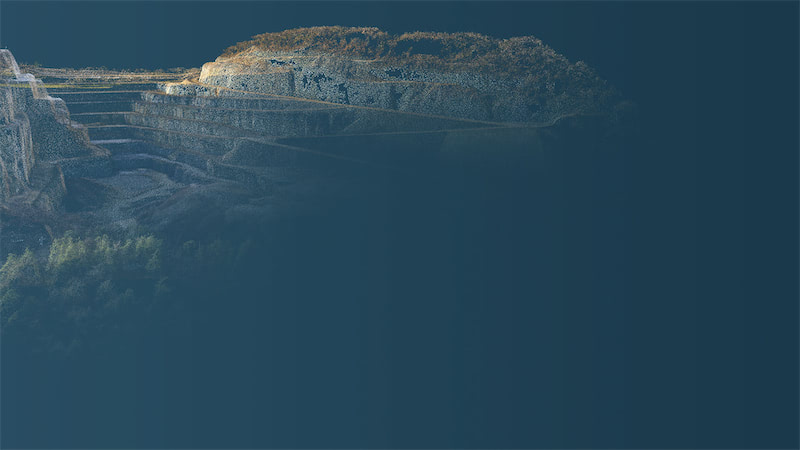
3D Point Cloud
A densified point cloud can be generated from drone images. Each point contains geospatial (X, Y, Z) and color information. It provides a very accurate model for distance (slant and horizontal), area and volume measurements.
Digital Terrain Model (DTM)
After filtering objects such as buildings, the drone images can be used to create DTMs with each pixel containing 2.5D information (X, Y, and Z value of the highest altitude).
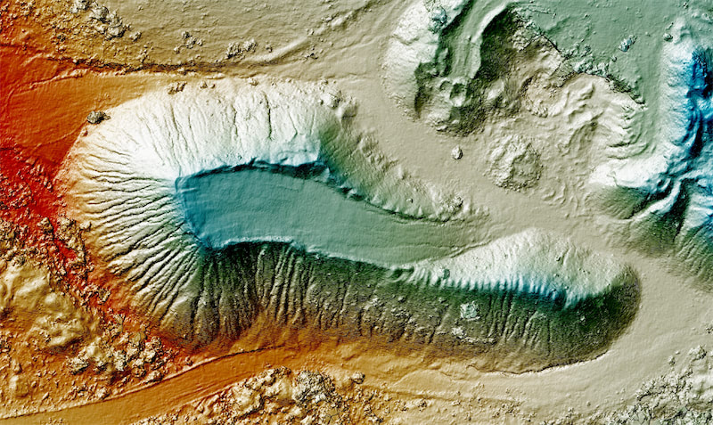
Curves / Contour Maps
Depending on the project requirements, either the DTM or DSM model, with custom contour intervals, can be used to create a contour lines map, giving you a better understanding of the surface of the area shot by the drone.
3D Textured Mesh
The 3D textured mesh is a reproduction of the edges, faces, vertices and texture of the area shot by the drone. This model is most useful for visual inspection or for when external stakeholders or public involvement is essential for a project.